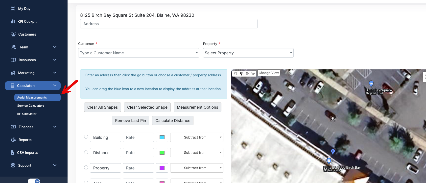
The Aerial Measurements tool is used to calculate measurements from a top down Aerial view of a property. Here you can take precise area measurements, calculate distances, and save these measurements to properties. To get to the Aerial Measurements page, go to Calculators > Aerial Measurements.
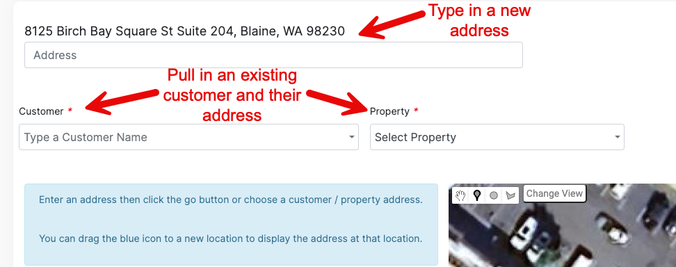
Here, you can pull up a new address, or open an address that is already in your Copilot account.
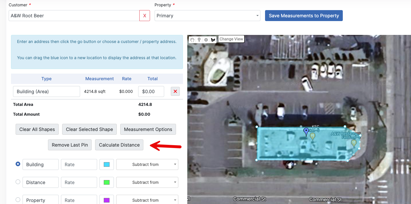
Once you have your property, now it's time to measure! Select the measurement you want to take, and select to draw a shape.
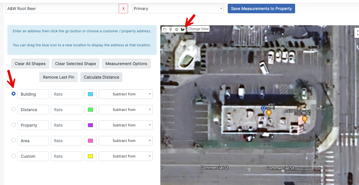
Click on the map to create marker points for the measurement area. Once you connect all of your points, it will fill in the shape you have mapped out, and display your measurement.
You can also calculate a distance by selecting Calculate Distance. This will allow you to calculate distance in a straight line.
Now draw your line!
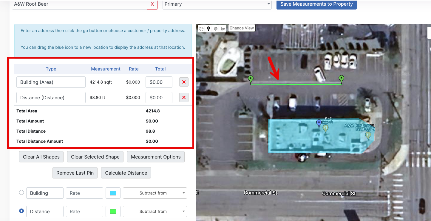
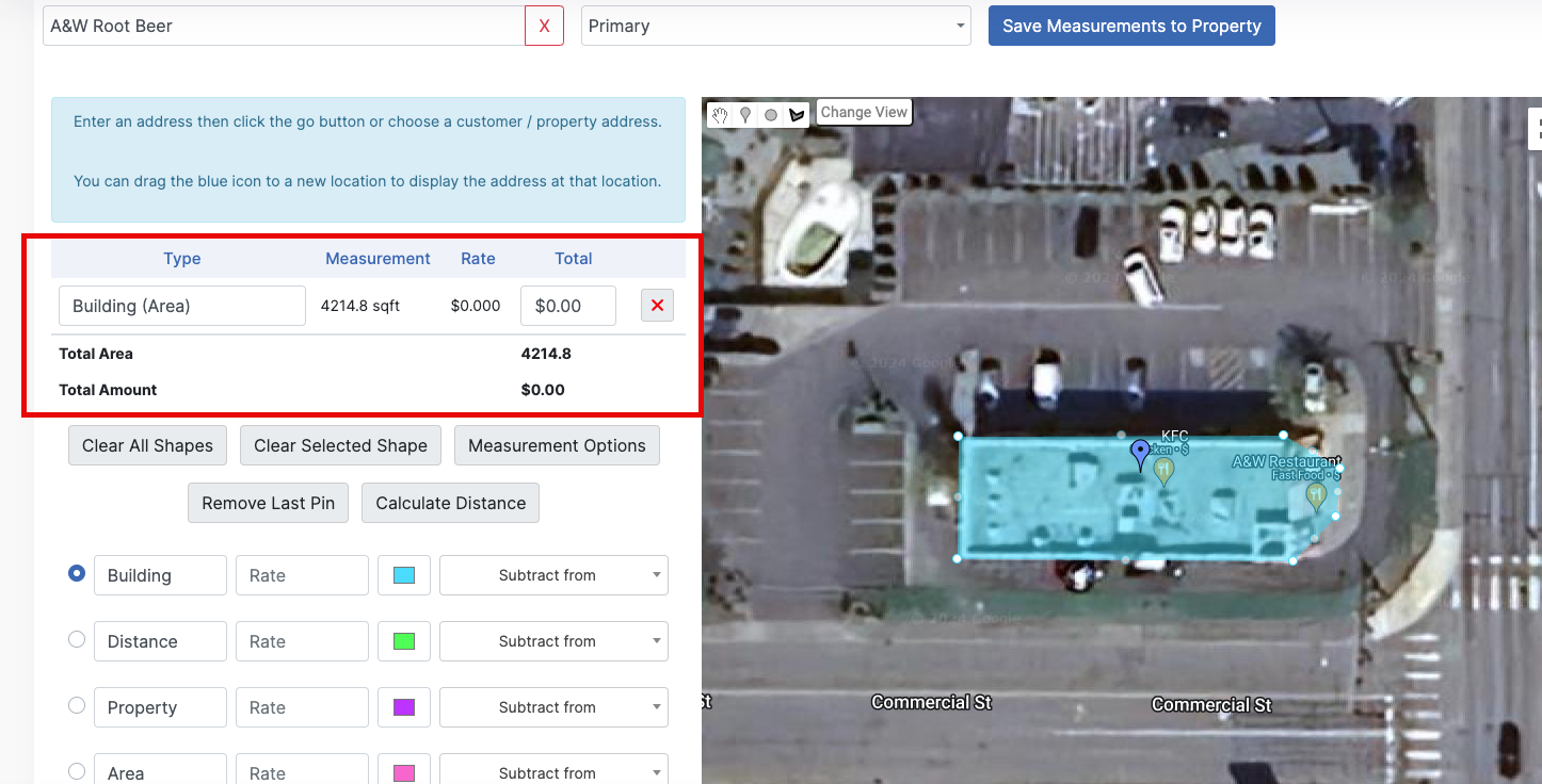
Now that we have a few measurements, you can set your rate charge to them if you would like to, but this is not always applicable.
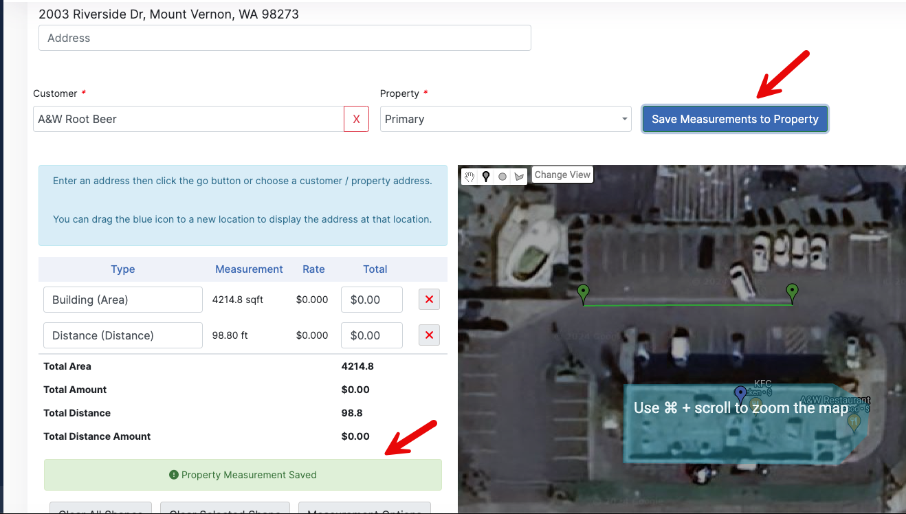
Since we have all the measurements we want, lets go ahead and save these to our property. To do so, click the blue Save Measurements to Property button. It will give you a green "Saved" message when it's done saving.
Now let's take a look at our property and see where those saved!
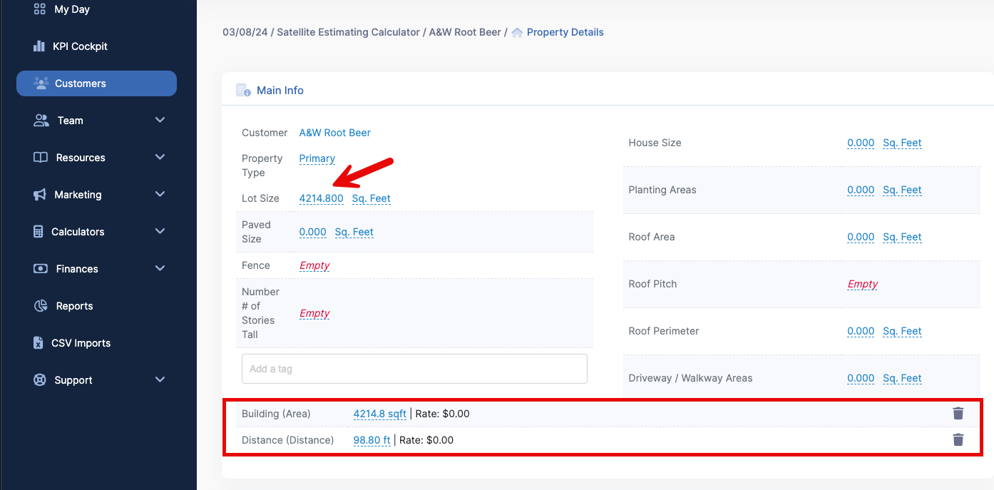
Looks like our two measurements saved, and the Building Area also added to the Lot Size calculation. If we had done a few more measurements, that Lot Size field would be a larger value, as it is built to calculate multiple of those measurements we can take.
This concludes the overview of the Aerial Measurements feature! There are a few other options that are on the Aerial Measurements page that we did not touch on, so I recommend you play around with the feature yourself and see all it has to offer!